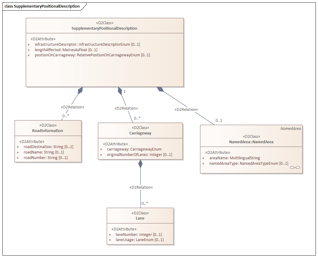
Element supplementaryPositionalDescription
The generic element supplementaryPositionalDescription provides additional location information, such as the specific lane, lanes, or length of a location. The element consists of one (or more) optional elements locationDescriptor and one (or more) required element(s) affectedCarriagewayAndLanes.
Attributes
| Attribute | Type | Required | Domain | Description |
|---|---|---|---|---|
| locationPrecision | MetresAsNonNegativeInteger | No | >=0 | Indicates that the location is provided with a precision better than the specified value in meters |
Elements
| Element | Type | Required | Domain | Description |
|---|---|---|---|---|
| infrastructureDescriptor | InfrastructureDescriptorEnum | No | atMotorwayInterchange, atRestArea, atServiceArea, atTollPlaza, atTunnelEntryOrExit, inGallery, inTunnel, onBridge, onConnector, onElevatedSection, onFlyover, onIceRoad, onLevelCrossing, onLinkRoad, onRoundabout, onTheRoadway, onUndergroundSection, onUnderpass, withinJunction | Description that identifies infrastructure to help identify the specific location |
| lengthAffected | MetresAsFloat | No | >=0 | Specifies the length (in meters) of the affected carriageway (and lanes) related to the associated traffic element |
| carriageway | Carriageway | 1 or more, see explanation | N/A | Specifies which part of the carriageway the location applies to |
| namedArea | NamedArea | No | N/A | An area defined by a name and/or known boundaries such as national or provincial borders or assigned control areas of an authority |
| roadInformation | RoadInformation | 0, 1 or more | N/A | Information about one or more roads. The location may correspond to part of the identified road, the entire identified section, or a combination of multiple sections |
Subelement carriageway
Using one or more carriageway elements, additional carriageway information is provided regarding (the endpoint of) the location.
| Element | Type | Required | Domain | Description |
|---|---|---|---|---|
| carriageway | CarriagewayEnum | Yes | connectingCarriageway, |
Specifies which part of the carriageway the location applies to |
| originalNumberOfLanes | Integer | No | N/A | Normal number of lanes, potentially available for through traffic, before reduction due to situations. Emergency lanes should not be counted unless they are sometimes operational for through traffic |
| lane | Lane | 0, 1 or more | N/A | Specifies a specific lane or group of lanes |
Note
The value 'slipRoads' in carriageway should only be used for messages where no specific lane indication is possible, such as "it’s slippery on the on- and off-ramps."
Subelement lane
| Element | Type | Required | Domain | Description |
|---|---|---|---|---|
| laneNumber | Integer | No | N/A | The lane number, with 1 being closest to the shoulder/edge and increasing towards the center median |
| laneUsage | LaneEnum | No | allLanesCompleteCarriageway, busLane, |
Specifies the specific lane the location refers to |
Subelement namedArea
An area defined by a name and/or known boundaries, such as national or provincial borders or assigned control areas of a particular authority. The attributes do not form a unit; instead, the smallest intersection forms the resulting area.
| Element | Type | Required | Domain | Description |
|---|---|---|---|---|
| areaName | MultilingualString | Yes | N/A | The name of the area |
| namedAreaType | NamedAreaTypeEnum | No | applicationRegion, continent, country, countryGroup, carParkArea, carpoolArea, fuzzyArea, industrialArea, lake, meteorologicalArea, metropolitanArea, municipality, parkAndRideSite, ruralCounty, sea, touristArea, trafficArea, urbanCounty, order1AdministrativeArea, order2AdministrativeArea, order3AdministrativeArea, order4AdministrativeArea, order5AdministrativeArea, policeForceControlArea, roadOperatorControlArea, waterArea | The type of area |
| country | CountryEnum | Yes | nl | Country of the sending party according to ISO 3166-1 |
Subelement roadInformation
| Element | Type | Required | Domain | Description |
|---|---|---|---|---|
| roadDestination | String | No | N/A | A destination associated with this road |
| roadName | String | No | N/A | The name of the road |
| roadNumber | String | No | N/A | The road number assigned by the road operator |
Example
<supplementaryPositionalDescription>
    <lengthAffected>500</lengthAffected>
    <carriageway>
        <carriageway>connectingCarriageway</carriageway>
        <carriageway>connectingCarriageway</carriageway>
    </carriageway>
</supplementaryPositionalDescription>